
Virginia is one of the best states for hiking in the Appalachian region. The Appalachian Trail alone covers 554 miles of the state—not to mention the miles of trails along the Blue Ridge Parkway, 43 state parks, 2 national forests, and a U.S. National Park.
After completing dozens of hikes myself, one trail remains at the top of my list based on (1) accessibility (2) difficulty (3) versatility (4) traffic and (5) views.
| Name | Mt. Pleasant via Henry Lanum Trail |
| Length | 5.9 mile loop |
| Difficulty | Moderate |
| Elevation Gain | 1,252 feet |
| Time | 3-4 hours |
| Kid-friendly? | Yes |
| Dog-friendly? | Yes |
| Backcountry Camping? | Yes, 3 primitive summit sites |
| Parking lot? | Yes, gravel |
| Fees | Free |
| Trail Markers | Blue Blazes |
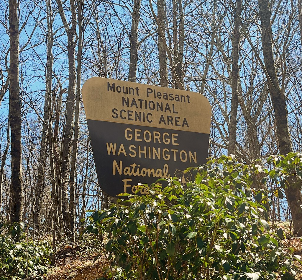
The Mt. Pleasant loop is a 5.9 mile hike in Vesuvius, VA. It is actually adjacent to the popular Cole (Cold) Mountain and uses the same access road within the George Washington National Forest.
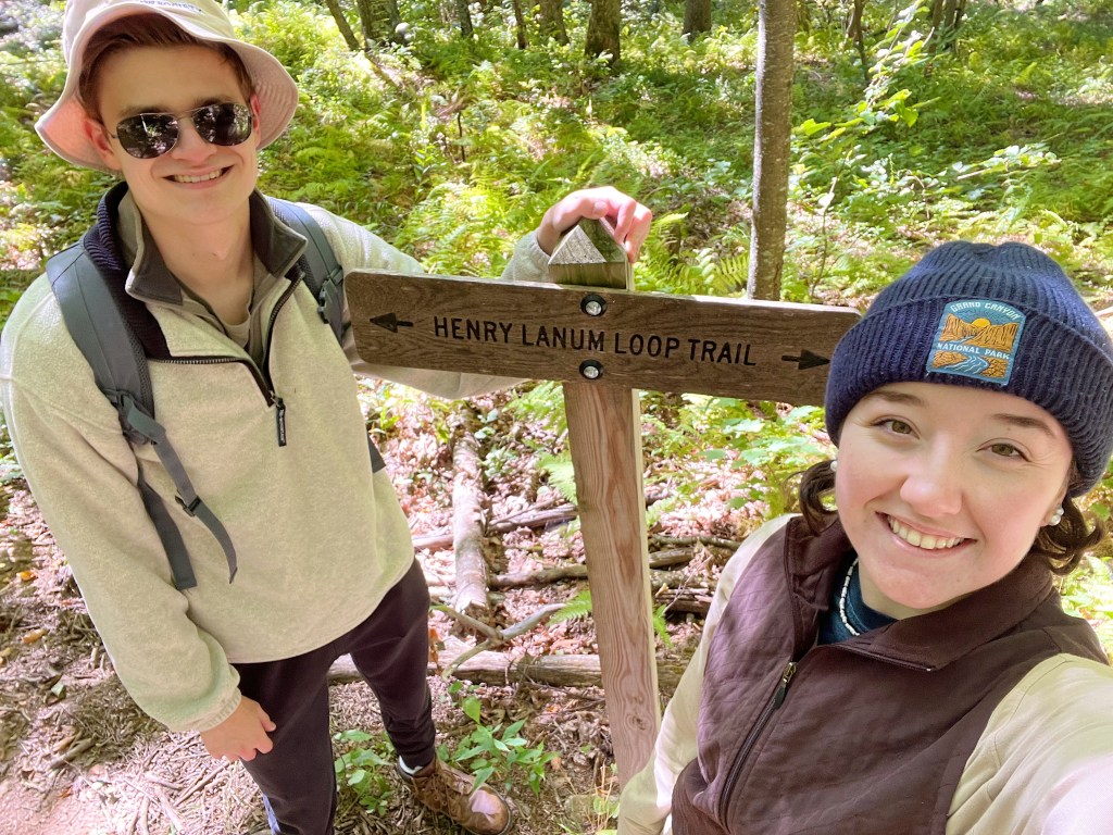
The trail honors Henry Lanum, a dedicated member of the Natural Bridge Appalachian Trail Club.
Accessibility
There are two routes to the parking lot. I would highly suggest taking the route below:
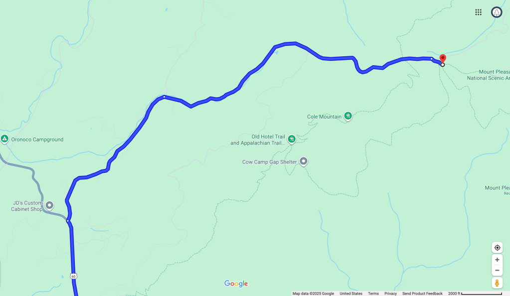
Directions: US Highway 60 (Lexington Turnpike) > State Road 634 (Coffeytown Road) > State Road 755 (Wiggins Spring Rd).
Follow Wiggins Spring Rd. to the “End of State Maintenance” sign, then continue on the gravel road. (Note: the gravel road is bumpy and may have large potholes after heavy rain. If you have a long and low vehicle, be cautious about bottoming out.)
Continue past the Hog Camp Gap road, the AT crossing, and Cole Mountain parking areas. Keep driving until you see the Mt. Pleasant Trailhead sign. Take a right into the parking area.
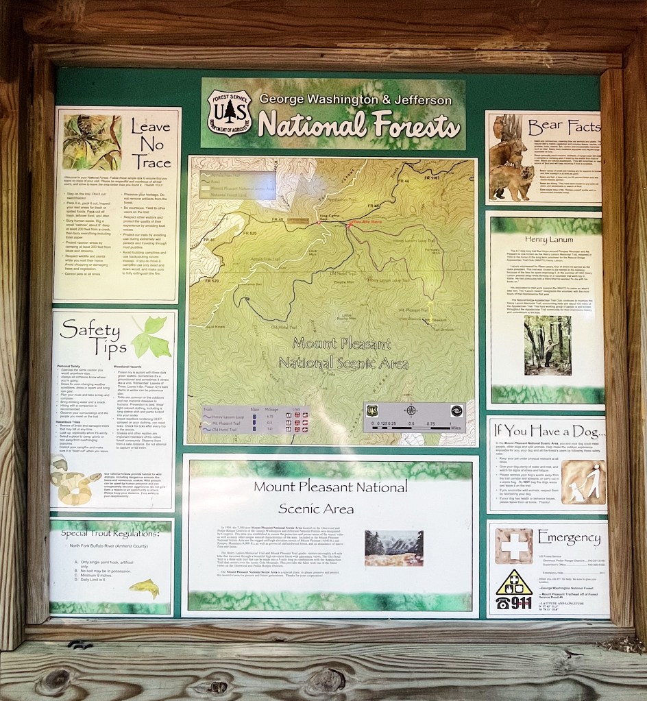
Parking is free. Stop by the travel kiosk for a trail map and helpful reminders.
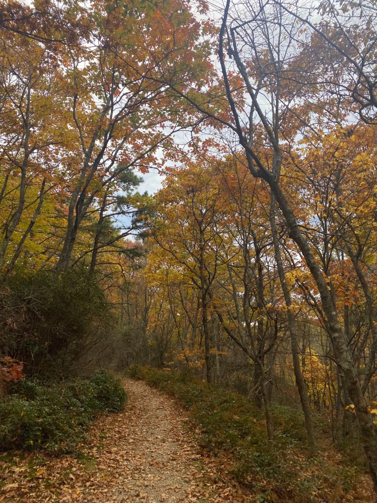
There is a sign for the start of the Henry Lanum trail. Some people suggest hiking the loop counterclockwise for a gradual incline. In my experience, I have not found much of a difference in either direction. Walk around a wooden horse gate to begin the hike to the summit.
A secondary route to reach the parking lot exists, and some hiking websites consider it a “hack”. I do NOT suggest taking the route below. The road turns into a single lane access road with steep drop-offs. It winds through a secluded holler and is barely wide enough to fit one car. Again, I do NOT suggest this route:

Difficulty
The Mt. Pleasant loop is rated “moderate” difficulty. The elevation gain is 1,252 feet and its estimated completion time takes 3-4 hours. The trail itself is a classic dirt and rocks pathway up the mountain.
The hike is definitely kid-friendly. If I run into other hikers, it is almost always a Boy Scouts or homeschool group. Dogs are also welcome but please abide by trail etiquette.
This is my go-to hike when taking my less-than-outdoorsy friends on an adventure. I’ve seen people complete this hike in tennis shoes (though I always recommend a good pair of hiking boots or trail runners). The incline is fairly gradual and it does not require an elite athlete to complete the trail.
Versatility
This loop is ideal for a day hike, backpacking, or traditional camping.
There are three backcountry campsites on the summit with gorgeous views of the sunrise. They each have a stone fire pit and ample room for tents or hammocks. In my experience, they are hardly ever occupied.
There is also a spot in the parking area for traditional camping with a fire pit. I have seen both Boy Scout tents and a camper set up. It is first come first serve.
Remember to abide by the “Leave No Trace” principles.
Traffic
The Mt. Pleasant loop has low foot traffic since it is located in a national forest rather than a state park. Most hikers tend to stop at Cole Mountain and do not venture further down the gravel road.
Out of my five trips, I have only encountered people twice. Most of the time, I have the entire trail and summit to myself.
Views
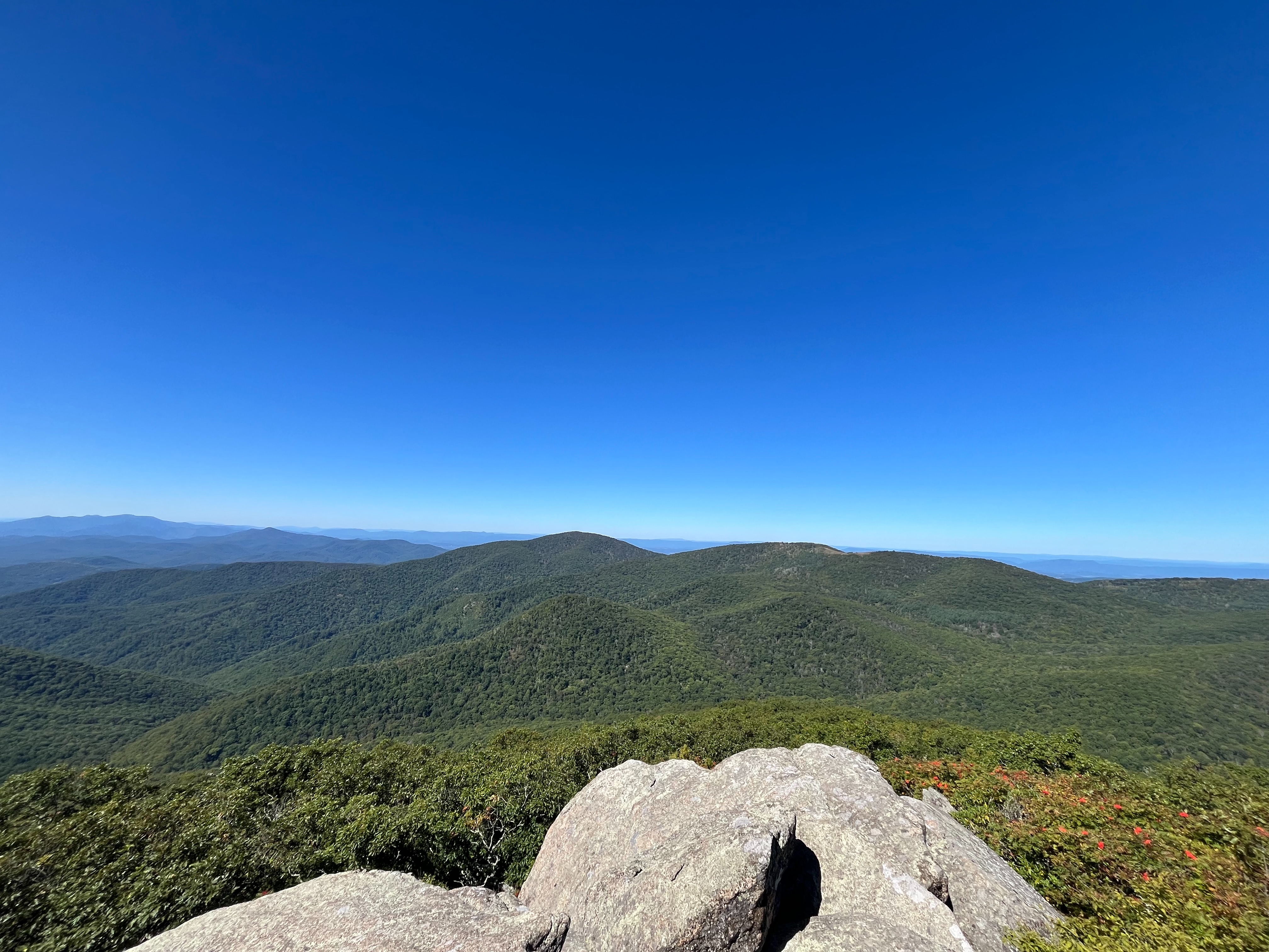
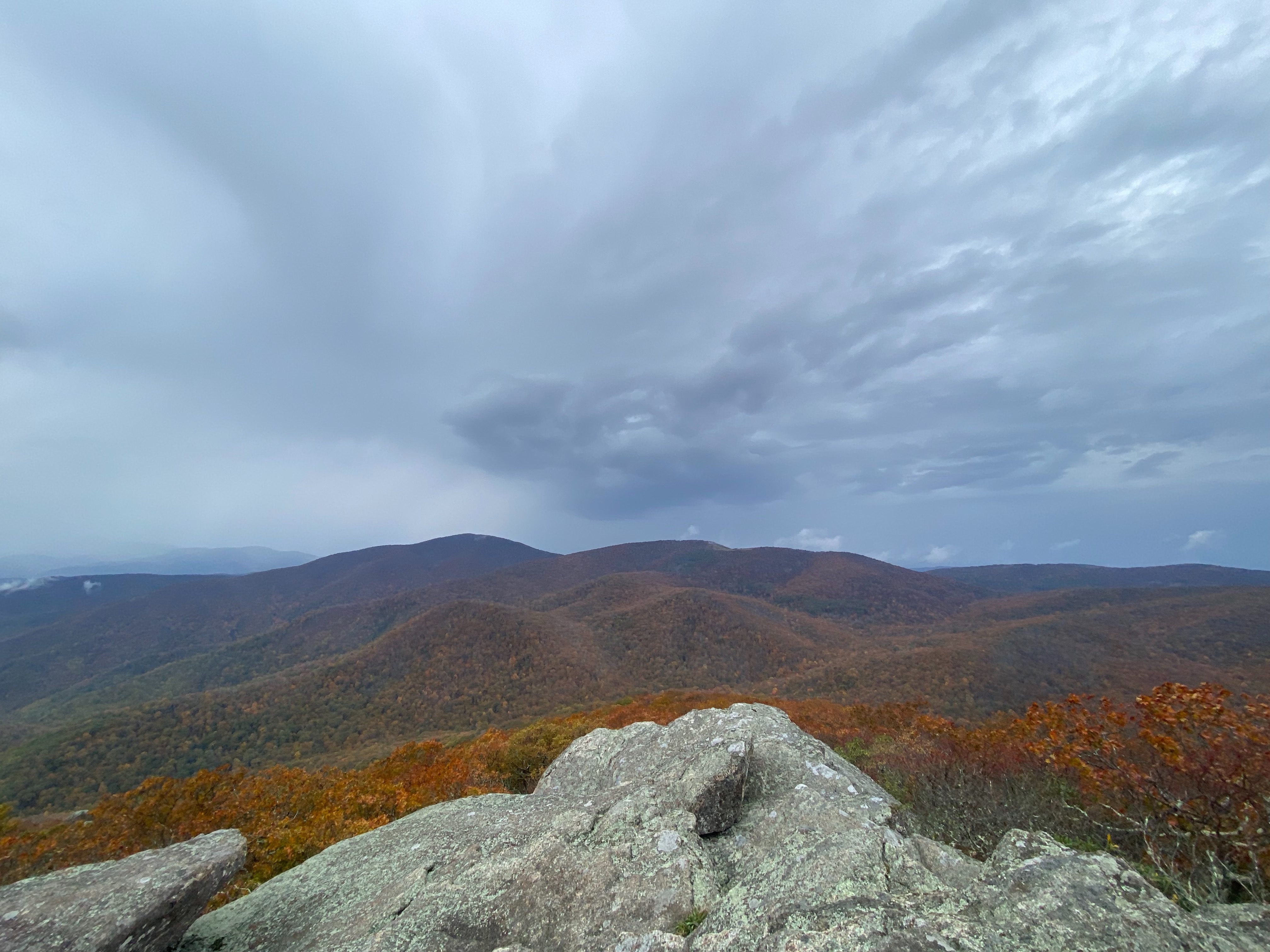
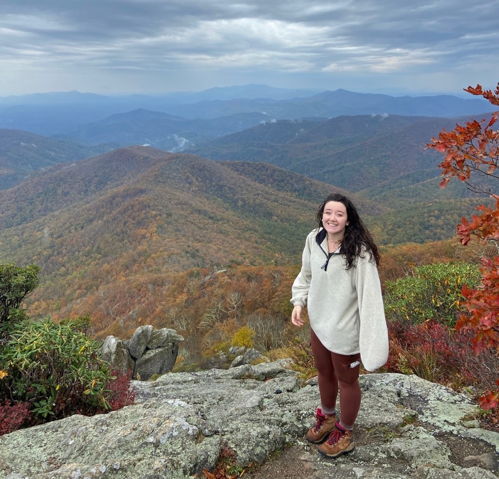
The view is the main reason this hike seals its place as my favorite.

There is an East and a West overlook. Both have incredible panoramic views of the surrounding mountains. There is no brush or foliage blocking the views. It is the perfect spot for leaf peeping in the fall or watching the sunrise. For the best fall leaves, I suggest going in mid-October.
I hope you embrace this opportunity to experience the rich scenery of the Appalachian region.
Let’s get back to our roots!
For more articles on outdoor exploration, check out our newest posts here.
Have something to share? Comment down below!


Leave a comment